Indirect Survey Module
The Indirect Survey module allows you to upload, review, and manage data from your indirect surveys. Once a survey file is uploaded, the data can be viewed on a map, in a table, or in a chart; exported to an Excel file or a PCS file or sent to SnapView for comparison; or included in reports. Flag spike options allow you to identify spikes in data and correct the invalid readings, while GPS options allow you to interpolate or replace invalid or incomplete GPS data.
Depending on your user type, some of these options may not be available to you. Refer to User Types for more information.
To access the Indirect Survey module, hover your mouse over the PCS Survey Manager title in the upper left corner of the screen and select Indirect Survey from the menu that displays.

Indirect Survey Module
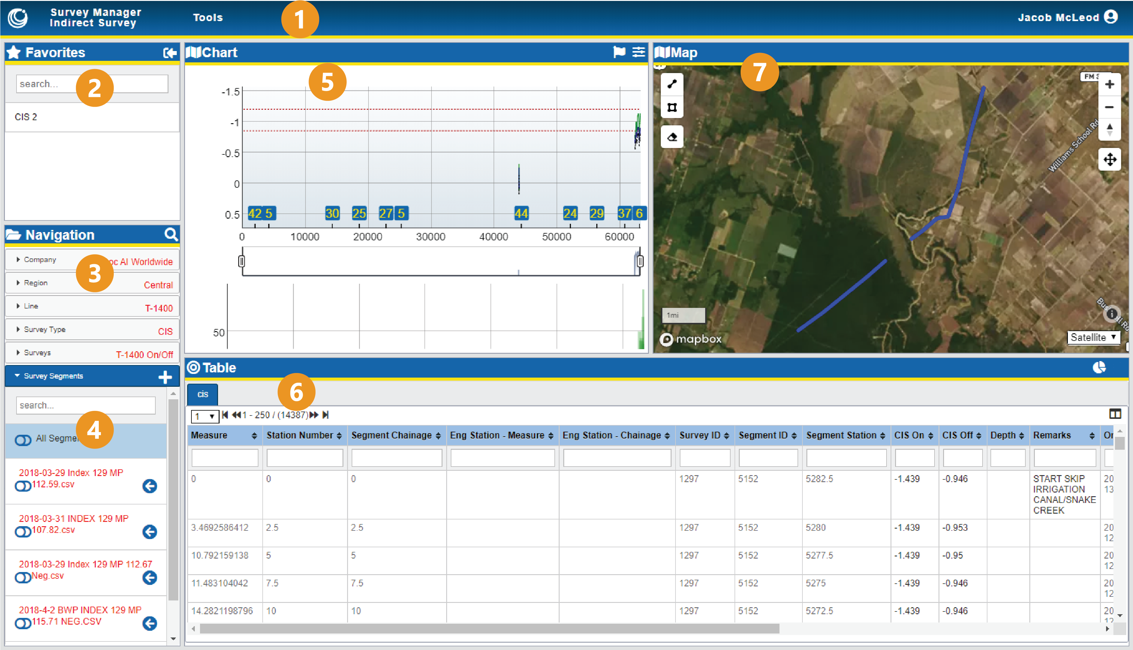
The Indirect Survey module consists of the following elements:
-
Tools menu — includes options on viewing or modifying the Chart. Refer to Tools Menu and Correct Survey Data for more information.
-
Favorites pane — lists surveys bookmarked for quick access or shared amongst your coworkers. Refer to Manage Your Favorite Surveys for more details.
-
Navigation pane — organizes survey data. Included in the Navigation pane is the Survey Segments tab, which stores the survey segment data. Refer to Manage Indirect Survey Hierarchy for more information.
-
Survey Segments folder — manages survey segments for the currently selected survey, allowing you to arrange the segments in the correct order and providing access to the survey segment data for review in the other panes or to download to your computer. Refer to Review Survey Segment Data and Download or Export Indirect Survey Data for more information.
-
Chart pane — displays the survey segment's readings in a chart format, as well as allows you to annotate and correct the survey data. Refer to View Data in the Chart for more details.
-
Table pane — displays the survey segment's readings in a standard table format of columns and rows, as well as allows you to annotate and correct some survey data and export modified data. Refer to View Data in the Table and Download or Export Indirect Survey Data for more details.
-
Map pane — plots the geolocated survey segment's data on a standard map. Refer to View Data in the Map for more details.