SnapView Module
The SnapView module allows you to align and compare data from multiple surveys for in-depth analysis. SnapView module also allows you to combine different surveys into an Overlay where geospatial survey points are within 10-300 feet of compared surveys. Up to the surveys of your choosing can be combined into an Overlay for in-depth analysis. You can select DEPOL, CIS, and DCVG Indirec Surveys for inclusion in an Overlay.
Complete the following steps to send a survey to the SnapView module:
-
From the Indirect Survey module, load the survey data in the Table pane.

Table Pane with Survey
-
Click
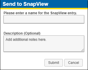
 to open theSend to SnapView window.
Send to SnapView Window
-
Enter a name for your SnapView survey entry.
-
Enter a description if desired.
-
Click Submit.
-
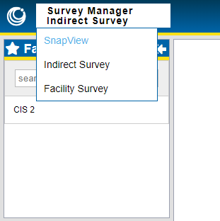
To view the SnapView survey you just created, open the SnapView Module by selecting it from the Survey Manager menu.

SnapView Menu Item
-
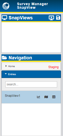
In the SnapView module, navigate to the survey (or Overlay) you wish to view, which are found under Staging folder.

SnapView Navigation
Once the survey data is added to SnapView, it can be viewed on a map, in a table, or in a chart. You can also add it to your Favorites, view information about it, move it to another folder, share it with other users, make edits to it, or delete it.
Review the following topics for more information about using the SnapView module: