Overview
PCS Survey Manager is a web-based visualization tool that displays your data in context, which allows you to rapidly identify potential problems with the survey data. You can then take immediate corrective action in the field or clean up the data in PCS Survey Manager.

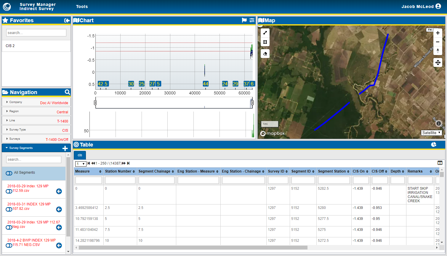
PCS Survey Manager Indirect Survey Main Display
You can collaborate between the field and the office with PCS Survey Manager to validate survey results while a crew is on-site. Once the survey is complete, you can use PCS Survey Manager to consolidate data from your survey crews for review, identify incomplete or incorrect survey results, and compare the current data with previous surveys.
You can also quickly identify potential data anomalies, align multiple surveys to create a single continuous survey, and clean up survey data. The interface includes map, chart, and table panes where you can review your survey data as location-based context for geolocated data points, reading values and their trends over distance, or all available information for individual records.
PCS Survey Manager also includes reports that provide a summary of your survey data in an easy to use and save format.
Once survey data has been verified, you can export the data for use in PCS, risk management systems, or GIS applications.
The user menu provides access to administrative functions, such as managing user accounts, updating column or icon mappings, or managing company logos.
PCS Survey Manager includes the following modules:
-
The SnapView Module module — display data from various surveys in one spot and compare data across survey types, survey dates, or technicians. Surveys can be overlaid on top of each other to corroborate results.
-
The Indirect Survey Module module — upload, review, manage, and share data from your indirect surveys.
-
The Facility Survey Module module — create custom facility surveys, import DAT survey files, group and assign surveys to users, review facility data in a table and on a map.