Unapped Facilities
Imported facilities that appear under the Unmapped tab could not be validated during the Import Bullhorn Bridge Mappings process. A counter in the Unmapped tab indicates the total number of unmapped facilities that have been imported for the selected account/group. Facilities are listed in rows that contain the following identifying information:
-
Unit Name
-
Channel Label
-
Bullhorn Engineering Unit Label
-
Bullhorn Facility ID
-
Sub Facility Name
-
Facility Type
-
Row Code And Pipeline
-
Milepost
-
Location Description
-
PCS Property
-
Latitude
-
Longitude
-
Bullhorn Serial Number
-
PCS Serial Number
Follow these steps to review and manage unmapped facilities:
-
Select the Unmapped tab at the top of the Mapping window.
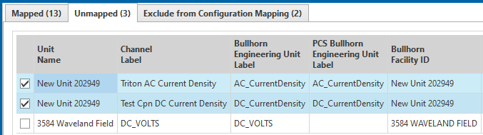
Unmapped tab
-
Review the information for each unmapped facility. The Auto-mapping feature in PCS will attempt to identify matched Bullhorn and PCS facility information.
-
Imported facilities that included matched Facility IDs and Engineering Unit Labels will be highlighted blue and their check boxes will be automatically selected, indicating that they can be successfully mapped.
-
Facilities without matched Facility IDs and Engineering Unit Labels can be managed using the drop down menus for the following:
-
PCS Facility ID
-
Subfacility Name
-
Location Description
-
PCS Property
At least two of these criteria must be input before a unit can be successfully mapped. Facilities meeting the requirements for mapping will be highlighted blue.
-
-
-
To manage unmapped facilities without matching Facility IDs or Engineering Unit Labels, click the drop down arrow for the information you want to search. To select units for exclusion from mapping, skip to step 6.
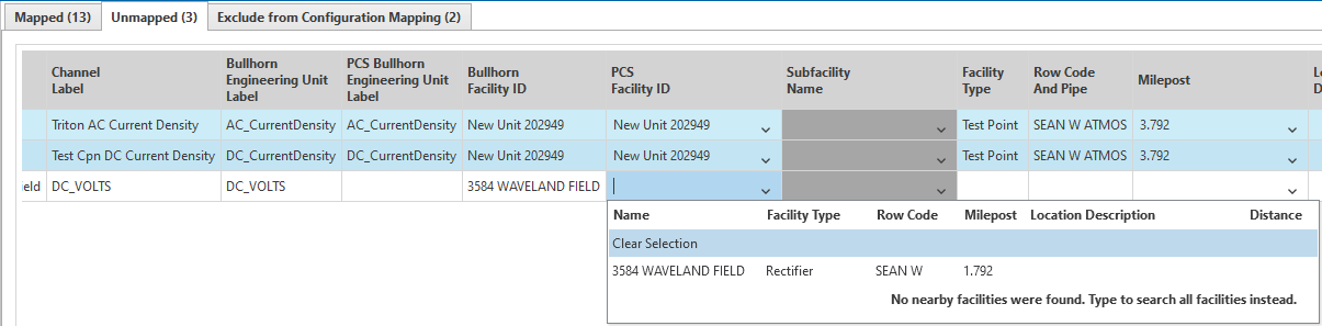
PCS Facility ID Drop Down
The PCS auto-mapping feature will provide a list of potential matches based on various data points, including Milepost, PCS GPS & Bullhorn reporting location, Facility IDs, and Location Description.
You may choose one of the option from the list, or click Clear Selection and manually input search terms into the field to generate a response.
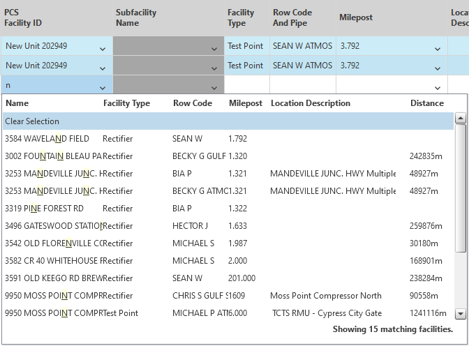
Manual Search
Distance indicates how far a facility in the search results is from the Latitude and Longitude logged in PCS. No distance will be shown for facilities that do not have Latitude and Longitude information in PCS. Facilities more than half a mile away may not appear in the search results.
Once search results have been selected for at least two of the required criteria, select the check box for the facility.
-
Ensure the check boxes for any facilities to be mapped are selected and click Save and Map in the blue Mapping window tool bar.
-
Click OK in the Save Changes Prompt.
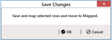
Save Changes Prompt
Selected facilities will appear under the Mapped tab in the Mapping window.
-
Follow these steps to exclude facilities from mapping:
-
Select the check boxes for any facilities under the Unmapped tab that you wish to exclude from mapping.
-
Click the Exclude from Mapping option in the blue Mapping tool bar.
-
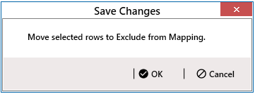
Click OK in the Save Changes prompt.
Save Changes Prompt
Excluded facilities will appear under the Excluded from Configuration Mapping tab in the Mapping window.
-
Proceed to the steps in Facilities Excluded from Configuration Mapping.