File Geodatabases Connections
An ArcGIS File Geodatabase is built with ArcGIS software and stored in a Windows folder format. The Windows folder will have a .gdb file extension.
Complete the following steps to connect to a File Geodatabase within CartoPac Studio's Solution Explorer window:
-
Right-click on Databases and select Add > Via Connection.

Add Via Connection
-
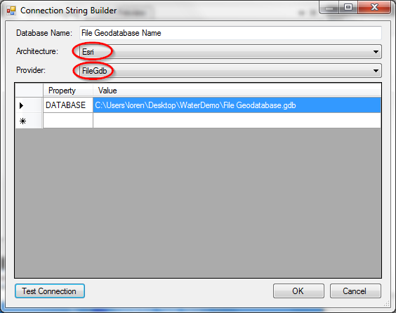
In the Connection String Builder window, set Architecture to Esri and Provider to FileGdb.

Connection String Builder Window
-
Browse to the appropriate location of the File Geodatabase and select it to add the database to the list of database connections.
-
Click OK to close the window.
Because a

ESRI Licensing Level
File Geodatabase connections are only supported in desktop workflows and are not supported in workflows utilizing CartoPac Server.