AOI Filter Templates
An AOI filter template is used on CartoPac Studio Solution Files without a Map Viewer where a map extent may otherwise not be selected. By default, every new CartoPac Studio Solution file contains at least one AOI filter template.
Pre-configured AOIs may be added to the existing AOI filter template.
Complete the following steps to add a new AOI to an existing AOI filter template:
-
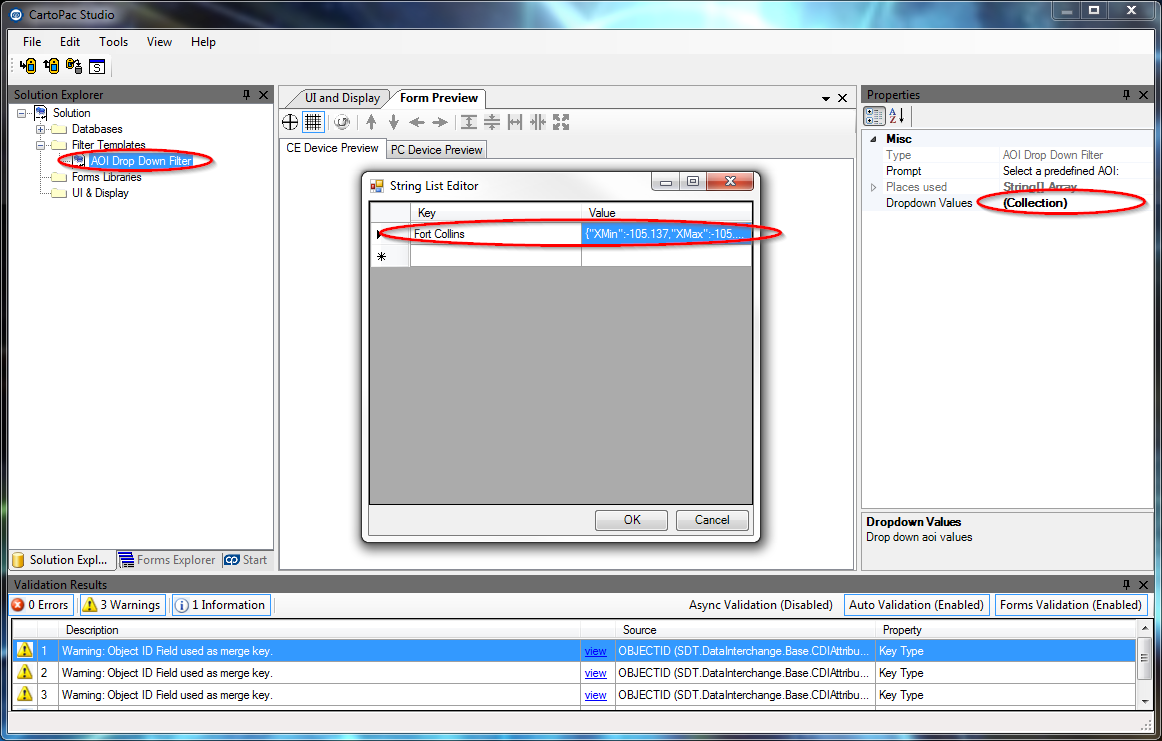
Open CartoPac Studio's Solution Explorer window and expand the Filter Template folder.
-
Click the AOI Drop Down Filter option.
-
Select (Collection) value of the Dropdown Values property in the Properties window and click the ... button to open the String List Editor window.

AOI Filter Template and Properties
-
Copy the Value from the existing Fort Collins Area of Interest, and paste it into a new record.
The Key names will be listed in the drop-down dialog window when downloading a project for selection. The Value string is formatted in JSON code using decimal degree values to specify the four corner points of a map extent for downloading a project by.
Map Extent values must be entered in decimal degree format using the WGS1984 Projection. ESRI provides a helpful reference for assistance in identifying the coordinates of any map extent on the esri.com website.