Geometry Service
CartoPac requires a Geometry Service from an ArcGIS Server in order to download features by Area of Interest (AOI). When CartoPac Server is initially configured, there is a default Geometry Service provided from ArcGISOnline. While this service is fine to use for small collection projects, it is not recommended for larger long term Server Deployments.
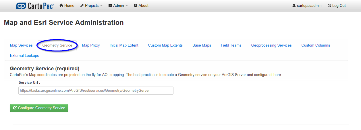
The Geometry Service tab on the Map and Esri Service Administration page defines what ArcGIS Geometry Service is used for capturing coordinate information in the map viewer.

Geometry Service Tab
The ArcGISOnline Geometry Service may only be utilized for a certain number of actions. While the number is large enough to suffice for the use of a small term project, it is not recommended for use with larger more long term Server Deployments.
Complete the following steps to configure a connection to a Geometry Service:
-
On the select the Map Viewer Administration page, click the Geometry Service tab.
-
click the Configure Geometry Service button.
-
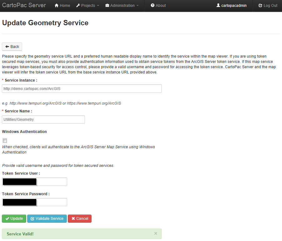
Enter the Service Instance and Service Name and any appropriate authentication settings to establish a connection to the ArcGIS Geometry Service.

-
Click Update.
Update Geometry Service