Map Extents and Basemaps
CartoPac Server allows a Single Initial Map Extent to be set for all users that is displayed immediately after authenticating to the Web Application.
There is only one initial map extent that may be set. Any user in CartoPac Server will see the initial map extent when accessing the Web Application.
When the Web Application is initially accessed by an administrator, the default initial map extent view is zoomed in too tight for basemap data to be displayed.

Select Extent
Complete the following steps to set an initial map extent:
-
Zoom out to an area to be used as the initial extent.
-
Click
 button to expand the Administrative Map Extent and Basemap buttons.
 -
Click the Set Current Extent as Initial Extent button.
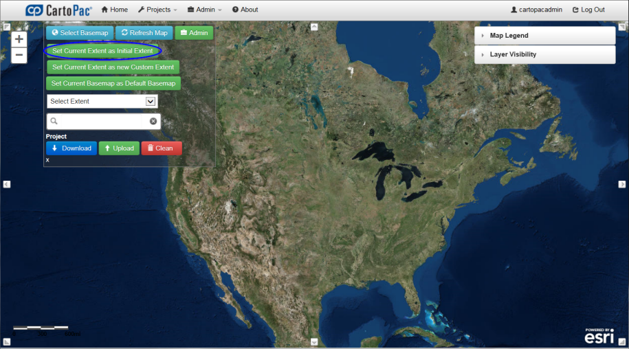
Set Current Extent as Initial Extent
-
TheConfigure Initial Map Extent menu is displayed with all latitude and longitude values defining the selected map extent. If desired, the latitude and longitude minimum and maximum values may be modified before clicking theSavebutton to save the configured extent as the Initial Map Extent. The area within the map viewer will be the defined extent displayed to all users when they log in to the Web Application.
-
Once the Initial Map Extent has been configured, it may be modified in the same way or alternatively modified through the Administration Map Viewer Administration page.

Map and Esri Service Administration - Initial Map Extent Tab
-
Click the Home button to return to the Map Viewer.

Configure Initial Map Extent Page