Implemented Points at Interval in CartoPac Touch
Version 10.1 ports the Points at Interval workflow from CartoPac Tablet to CartoPac Touch. This workflow allows users to create point features at specified intervals along the length of a line segment. This functionality can be used to create a point at either linear vertices or a user specified interval (Feet, Meters, Yards). The user will be prompted to input the point feature class, interval type, units, and interval. When executed, it will create points along the length of line, following the bearing of the line.
The workflow can be accessed via the top toolbar of the CartoPac Touch application after the Hamburger button is pressed, under the ‘Spatial Operation’ button as seen below:
-
Tap the Spatial Operation button to open the Spatial Operation Menu.

Spatial Operation Button
-
Select Add Points at Interval.
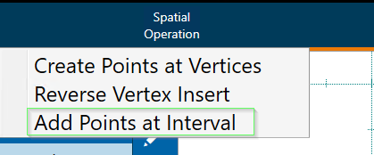
Spatial Operation Menu
-
In the Points at Interval dialog, enter the desired interval and units.
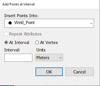
Points at Interval Dialog
Users should be trained on the workflow to prevent inadvertent use.